
CartographicÉpoque moderne· XIXe siècle
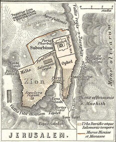
Topographic map of Jerusalem
Enrich the Great Book

Description
Detailed cartographic survey of the city of Jerusalem and its surroundings, produced by explorers and learned societies of the nineteenth century. It distinguishes the old city, the ramparts, and the holy places.
Significance
It reflects the rise of topographical studies of the Holy Land and the scholarly rediscovery of Jerusalem.
Features
- Provenance
- Europe
Other objects — Cartographic
Madaba Map
Madaba, Jordanie
Plan of Jerusalem and the Temple
Diaspora
Map of the Holy Land printed in Amsterdam
Amsterdam
Engraved plan of the Temple of Jerusalem
Europe
Pilgrimage itinerary to the tombs of the righteous
Terre d'Israël
Amsterdam-printed plan of the Temple courtyard (mishkan)
Pays-Bas (Amsterdam)